Quantcast
Channel: News – DroneMapper
Viewing all 100 articles
Browse latest View live

Drone Imagery to 3D Game Engine and Virtual Reality

$
0
0
[cs_element_section _id=”1″][cs_element_row _id=”2″][cs_element_column _id=”3″]drone-imagery-blender

We’ve updated our sample page to include a Blender project with the high resolution Red Rocks virtual reality scene. We’ve also added a download link to the .OBJ, .MTL and .PLY files for import into Unity3D or other 3D rendering software. Creating real world scenes in VR quickly from drone imagery is possible using an oblique collection and our processing software.

The image above shows a 3D Textured Mesh Point Cloud converted to .OBJ format displayed in Blender. The .OBJ has an associated .MTL and .JPG file to provide the texture and material mapping.

download processed products in .OBJ
download processed products in .PLY
download Blender 3D project

We’d love to see how you use this data in your own projects! Let us know

[/cs_element_column][/cs_element_row][/cs_element_section]

The post Drone Imagery to 3D Game Engine and Virtual Reality appeared first on DroneMapper.


Big Data Photogrammetry Processing

$
0
0
[cs_element_section _id=”1″][cs_element_row _id=”2″][cs_element_column _id=”3″]big-data-drones

Processing billions of pixels over large areas at high resolution requires serious computing power and algorithms. The image above shows an Orthomosaic map with a Ground Sample Distance (GSD) of 3 cm spanning an area of over 250 acres. The original imagery was obtained using a Precision Hawk fixed wing UAV system and processed by DroneMapper cloud.

Give us a call to discuss your application and how we may possibly help in the solutions you need.

[/cs_element_column][/cs_element_row][/cs_element_section]

The post Big Data Photogrammetry Processing appeared first on DroneMapper.

Drone Mapping API and Cloud Processing

$
0
0
drone api

DroneMapper Cloud is an API for photogrammetric processing of aerial images. The API allows a developer to programatically interact with our Drone Mapping algorithms to generate georeferenced Digital Elevation Models, Orthomosaic Maps and Point Clouds with or without Ground Control Points (GCP).

After 7 years, we’ve retired our original web based cloud processing system and API — this is the new generation of that API. It combines our latest algorithm developments and processing experience into an enterprise focused cloud product.

API Documentation
Python Source Code Example w/ .ZIP File Download & Webhook

The API has an extensive processing dashboard and web based user interface. The UI allows an operator to upload imagery, download processed products, view results in 2D or 3D, make map based GIS measurements (Area, Distance, Slope, Volume) and more.

Request API Access

point cloud api

The post Drone Mapping API and Cloud Processing appeared first on DroneMapper.

REMOTE EXPERT – Efficient, Affordable Desktop Photogrammetry

$
0
0
KEY BENEFITS:

  • Eliminate downtime associated with cloud processing data transfers,
  • Control your DEM, ortho and point cloud processing time using selectable resolution,
  • Utilize the ortho preview function at the job site to verify imagery collection quality,
  • Generate high accuracy maps with control and built in GCP/imagery association tool,
  • Modest computing resources (4 core or more CPU, 16 GB RAM, Windows 10 OS) required to support the application.
PRICING and SUPPORT:

  • Perpetual license - $999 (no other fees ever),
  • Month-to-month license - $100/month (3 month minimum),
  • Full hands on training and support (4 hours) - $500
  • DroneMapper also provides end-to-end support including: mission planning and execution, camera set up, control placement and generation of application specific products (contours, volumetrics, planimetrics, DTMs, etc.) using GIS software (Global Mapper).
NEW FEATURES:

  • New Orthomosaic functionality, multi-threading (BETA)
  • Orthomosaic seamline feathering (BETA)
  • FULL CHANGELOG
Let us know how the DroneMapper team can help.

The post REMOTE EXPERT – Efficient, Affordable Desktop Photogrammetry appeared first on DroneMapper.

Hyperspace Challenge 2018

$
0
0


DroneMapper is very pleased to announce that it has been selected as one of the ten finalists for the Hyperspace Challenge 2018 - Data Analytics competition.
Please see the following link for more details on the ten companies selected to participate:

http://hyperspacechallenge.com/announcing-finalists-for-inaugural-hyperspace-challenge/

The goal of the challenge is to connect start-up companies with cutting edge technologies and defense users in order to address and solve some of the warfighter's pressing problems. Problem statements included:
  • Remote estimation of forest density for mobility analysis,
  • Automated electrical utility change detection,
  • On-demand geo-spatial data for Target Audience Analysis,
  • Remote assessment of infrastructure conditions,
  • Rotorcraft automated identification of terrain and obstacles in visually degraded environments.
The challenge will culminate the week of November 13-16, 2018 in Albuquerque, NM. There, the companies invited and the defense users will meet, discuss the problems and formulate solutions. We hope to bring our experience and expertise in image processing to help solve these problems.

The very best from the DroneMapper team!

The post Hyperspace Challenge 2018 appeared first on DroneMapper.

DroneMapper Rapid / Remote Expert Release: 20181120

$
0
0


DroneMapper Rapid and Remote Expert Version 20181120 has been released. Please download the latest version here. This release has the latest UI modifications, back-end API performance enhancements and features. See the full change log below:

  • New orthomosaic functionality, multi-threading (BETA)
  • Orthomosaic seamline feathering (BETA)
  • Alternate initial tie-point computation by image center distance to neighbors
  • Added functionality to compute DEM / Ortho at native resolution
  • Various bug fixes and API updates
  • UI improvements and updates
  • New real-time API log viewer window
  • Updated/improved 3D textured mesh creation
  • Improvements/simplification of mask creation tool
  • Generate undistorted TIF images based on aerial triangulation results
  • Process stereo pairs/epipolar imagery
  • Allow RAPID users dense processing mode (4x native DEM) and 2x native ortho options
  • Allow RAPID users ability to radiometric blend ortho tiles/seamlines
  • Deprecated REMOTE version
  • Updated processing form icons
  • Fixed GSD reporting truncation issue
  • Updated UI layout
  • Updated UI components/icons
Best regards,
the DroneMapper Team

The post DroneMapper Rapid / Remote Expert Release: 20181120 appeared first on DroneMapper.

DroneMapper Rapid / Remote Expert Release: 20190201

$
0
0
multispectrial-tifrgbnir
DroneMapper Rapid and Remote Expert Version 20190201 has been released. Please download the latest version here. This release has full support for multi-spectral tif input and output. RGBN 8bit/18bit, RGB+n(bands), Single Band 8bit/16bit tif/Thermal/Hyperspectral. Example imagery shown is 22 frames from a Vexcel UltraCam Falcon Prime (RGBN). See the full change log below:

February 2nd, 2019 - v1.4 20190201
  • 1500 images max for Remote Expert
  • Multispectral TIF processing (RGBN/RGB+nNumberOfChannels)
  • TIF image support (8bit/16bit)
  • Rename .DIS (disabled images on program exit)
  • Additional testing and optimizations of AMD processors
  • UI enhancements
Best regards,
the DroneMapper Team

The post DroneMapper Rapid / Remote Expert Release: 20190201 appeared first on DroneMapper.

DroneMapper Updated UI Screenshots – Digital Elevation Model and Orthomosaic


Review on UAS Photogrammetry Processing Options – Ukraine, August 2018

$
0
0
We often get inquiries from around the world on how DroneMapper software compares with the other options available to you as UAS surveyors and mappers. We were just made aware of a reasonably comprehensive review of the options conducted by:
50n
50 (deg) NorthSpatial in the Ukraine. Their review can be found here: http://www.50northspatial.org/uav-image-processing-software-photogrammetry/.

Both advantages and disadvantages as well as cost for all of the options available to you are discussed. We hope that this information provides insight on the available options for you to consider for your specific applications and needs. As always feel free to contact us with specific questions and how we might help in providing solutions.

The DroneMapper Team

The post Review on UAS Photogrammetry Processing Options – Ukraine, August 2018 appeared first on DroneMapper.

DroneMapper Open Source Projects

$
0
0
We are starting to release certain projects back to the open source community. You can find these new projects on our GitHub page here. We will continue to develop and contribute to these projects as time permits!

ArUco geobits: We've developed an aerial ground control point target system similar to a QR code. Our GCP targets are digitally encoded fiducial markers with computer vision software functionality to enhance workflows and provide the highest accuracy possible for photogrammetry missions.


ArUco geobits @ github

NodeMICMAC: NodeMICMAC is a Node.js App and REST API to access MicMac. It exposes an API which is used by WebODM or other projects. This project is sponsored and developed by DroneMapper. This repository was originally forked from NodeODM, which is part of the OpenDroneMap Project.


NodeMICMAC @ github

Make a pull request for small contributions. For big contributions, please open a discussion or issue first. Feel free to contact us with questions!

Thanks, DroneMapper Team

The post DroneMapper Open Source Projects appeared first on DroneMapper.

NodeMICMAC – a new WebODM Node

$
0
0
Original Article @ OpenDroneMap

Origins

OpenDroneMap has an origins story rooted in a joke:

While the last decade has been dominated by the growing hegemony of the global base map, mapping will swing now for a while towards the principle of mapping the world, one organic pixel at a time. 2014 is the beginning of artisanal satellite mapping, where we discover the value in 1-inch pixels from personally and professionally flown unmanned aerial systems (drones). There is, as all things military-industrial, the dark side of drones. But as with all of these technologies, we will be discovering the great democratizing power of the artisanal, as applied to ‘satellite’ views.

OpenDroneMap anyone?

So many FOSS options… .

There are plenty of communities, spaces, and markets for Free and Open Source (FOSS) projects: in the web map rendering world we have MapServer and a dozen upstarts. In the map javascript world OpenLayers, Leaflet, and the GL ilk and more. At the lower level, we have JTS Topology Suite, GEOS, and all their derivatives.

After making the 2014 prediction post and then deciding to start OpenDroneMap, I had a doubt: what if someone comes along and creates something better? What if something better already exists? What if there is no point to the work? And then I remembered all the above and relaxed. Also, if someone comes along and creates something better, in the informal parlance: yay for the world!

The challenge

The reality when I started the project was there was an existing project that was FOSS and was photogrammetry for drones and other small cameras: MICMAC. It’s exquisite: great quality, fully FOSS being a CeCILL-B (I like to think of it as a French version of the GPL (edit — it’s the French version of the lesser GPL), but IANAFL [I am not a French Lawyer] and not completely sure that’s correct), and at the time, difficult to use for non-French speakers.

MICMAC has evolved a lot since then, with better docs and community posts in both French and English, however usage of it can still be a challenge. Free and Open Source is hard. It can be hard for users, it can be hard for maintainers. So, it is such a relief when FOSS becomes ever so much easier.

The hook

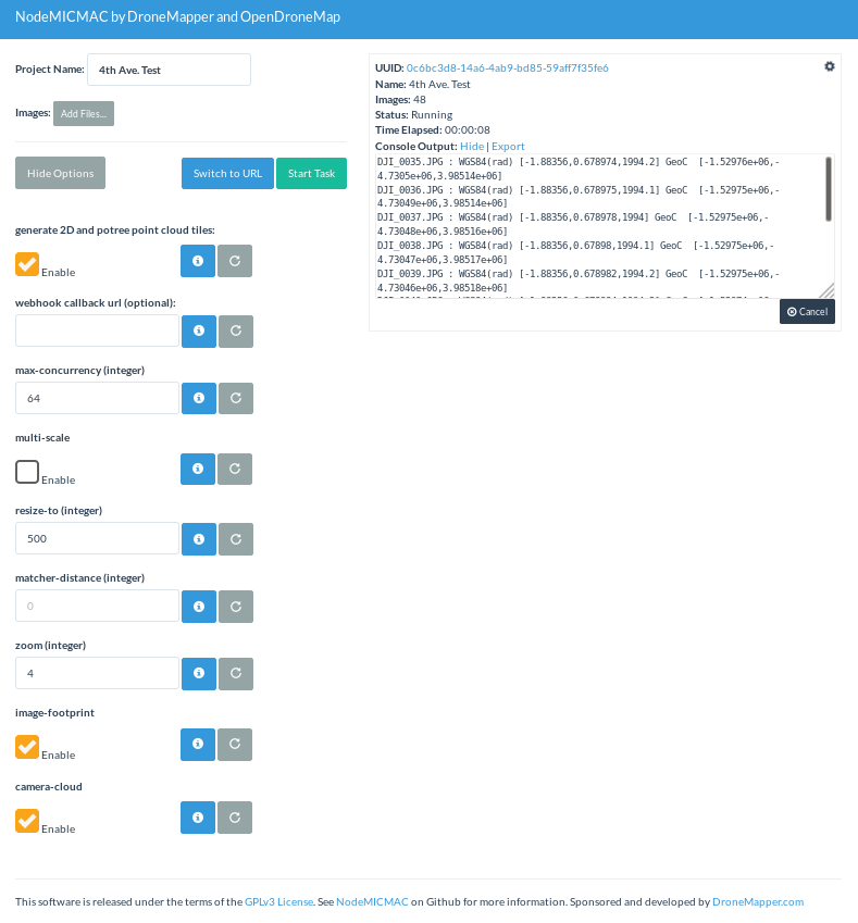
So, it is with some excitement that I turn your attention to NodeMICMAC. NodeMICMAC is a fork of NodeODM, and thus provides web API access to MICMAC, in the same way that NodeODM does for OpenDroneMap’s command line ODM application.

NodeMICMAC makes using MICMAC really easy, and should slot into the OpenDroneMap ecosystem pretty seamlessly, thanks to JP and the folks at DroneMapper.

When we spoke with JP, I was curious about his motives: this is such a cool move that changes the industry. Why? The answer: for the same reasons that we work on OpenDroneMap, to grow this really cool open photogrammetric ecosystem.

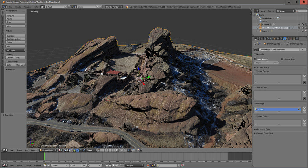
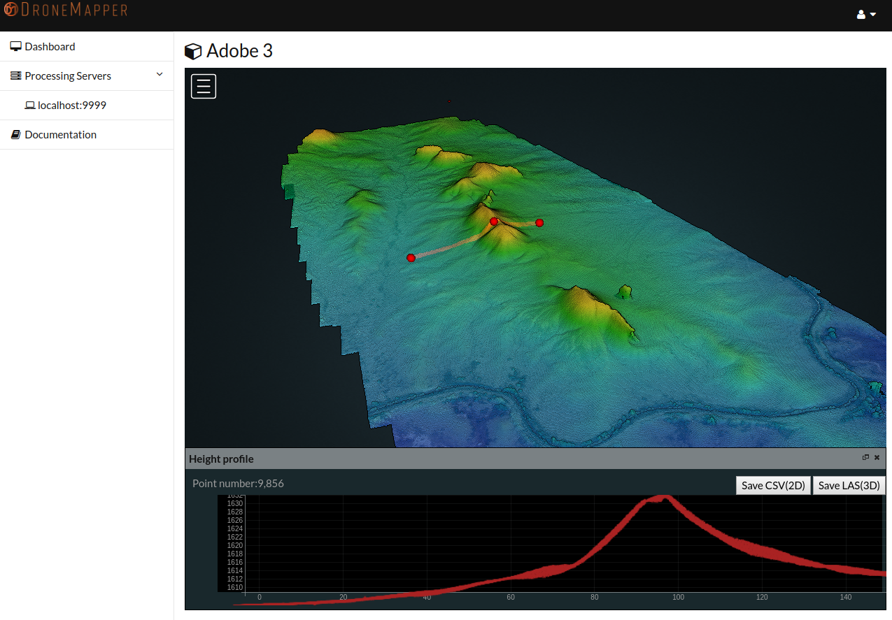
(Sidenote: check out DroneMapper’s geoBits: ArUco Ground Control Point (GCP) Targets and Detection for Aerial Imagery — more on that later — so cool!).
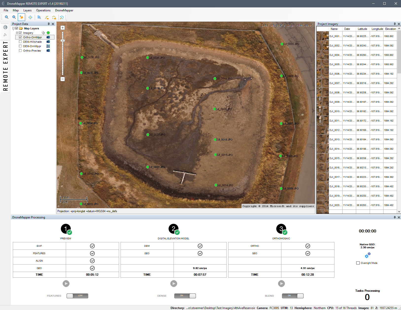
Results

But, you may ask, how does it stack up? Frighteningly well. If you have been paying attention to the improvements in OpenDroneMap the last couple of years, you may have noted orders of magnitude improvements in every step in processing. Even with these, MICMAC shows us how a mature photogrammetry project should display its wares.

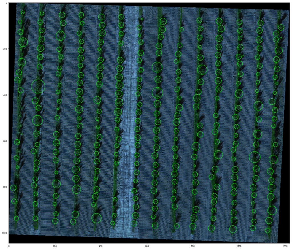
Point cloud comparisons 
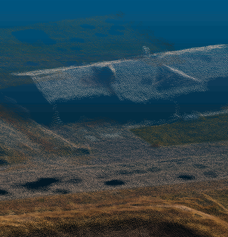
ODM vs. MICMAC’s point cloud over a house:

Animation comparing point cloud for house from MICMAC to OpenDroneMap

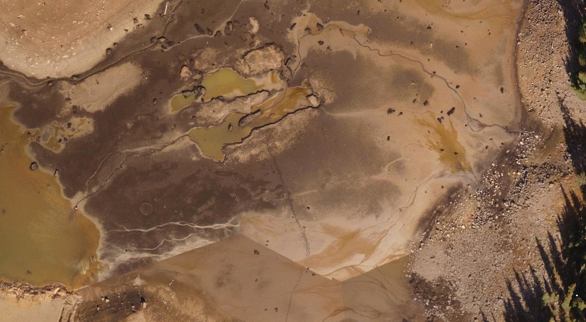
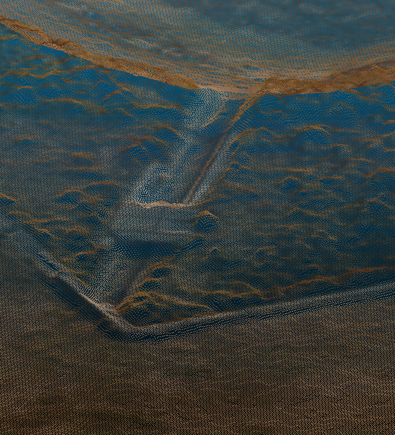
ODM vs. MICMAC’s point cloud over a drainage:

Animation comparing point cloud for ditch from MICMAC to OpenDroneMap

Orthophoto Comparison

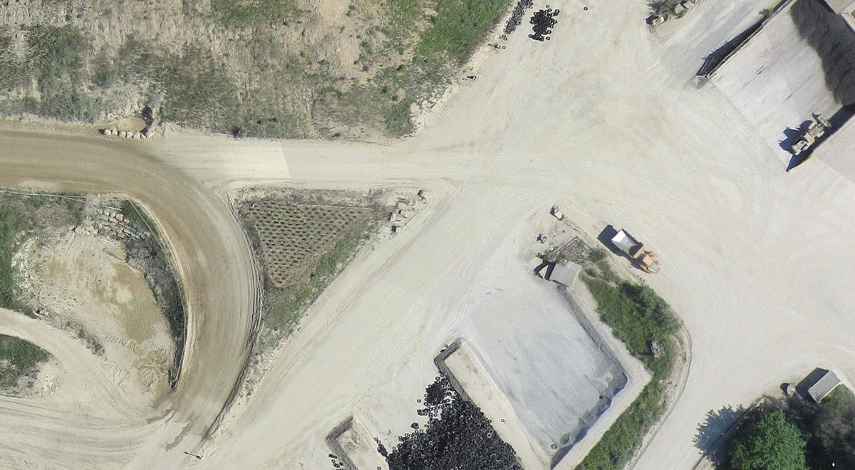
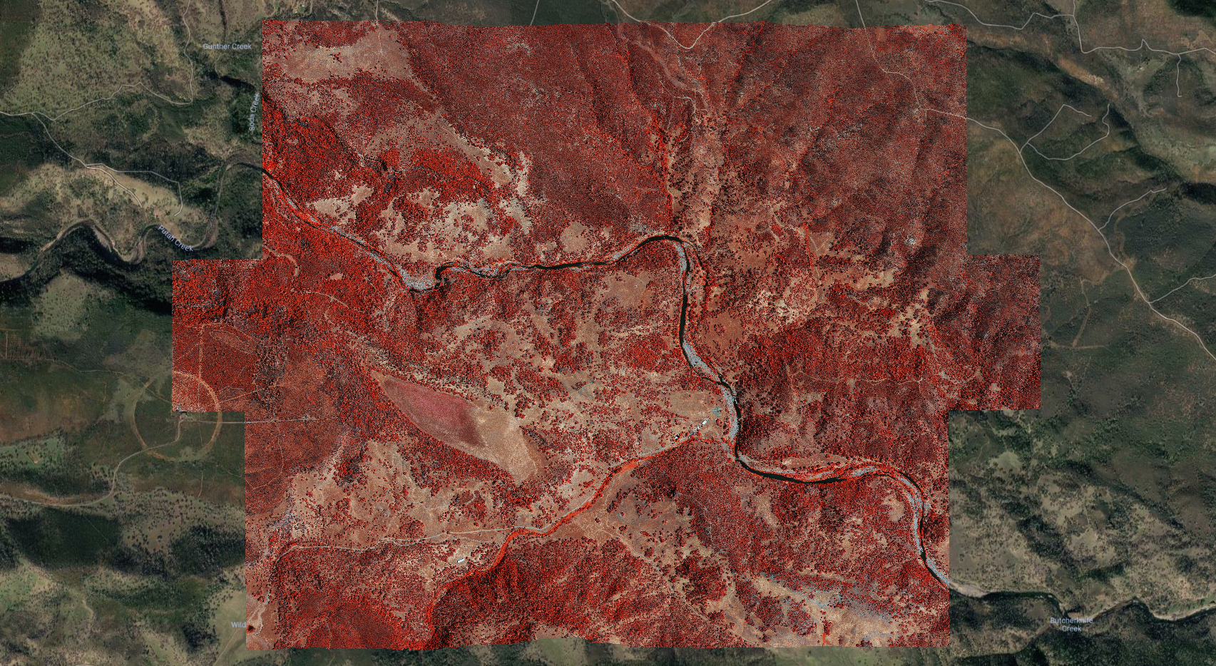
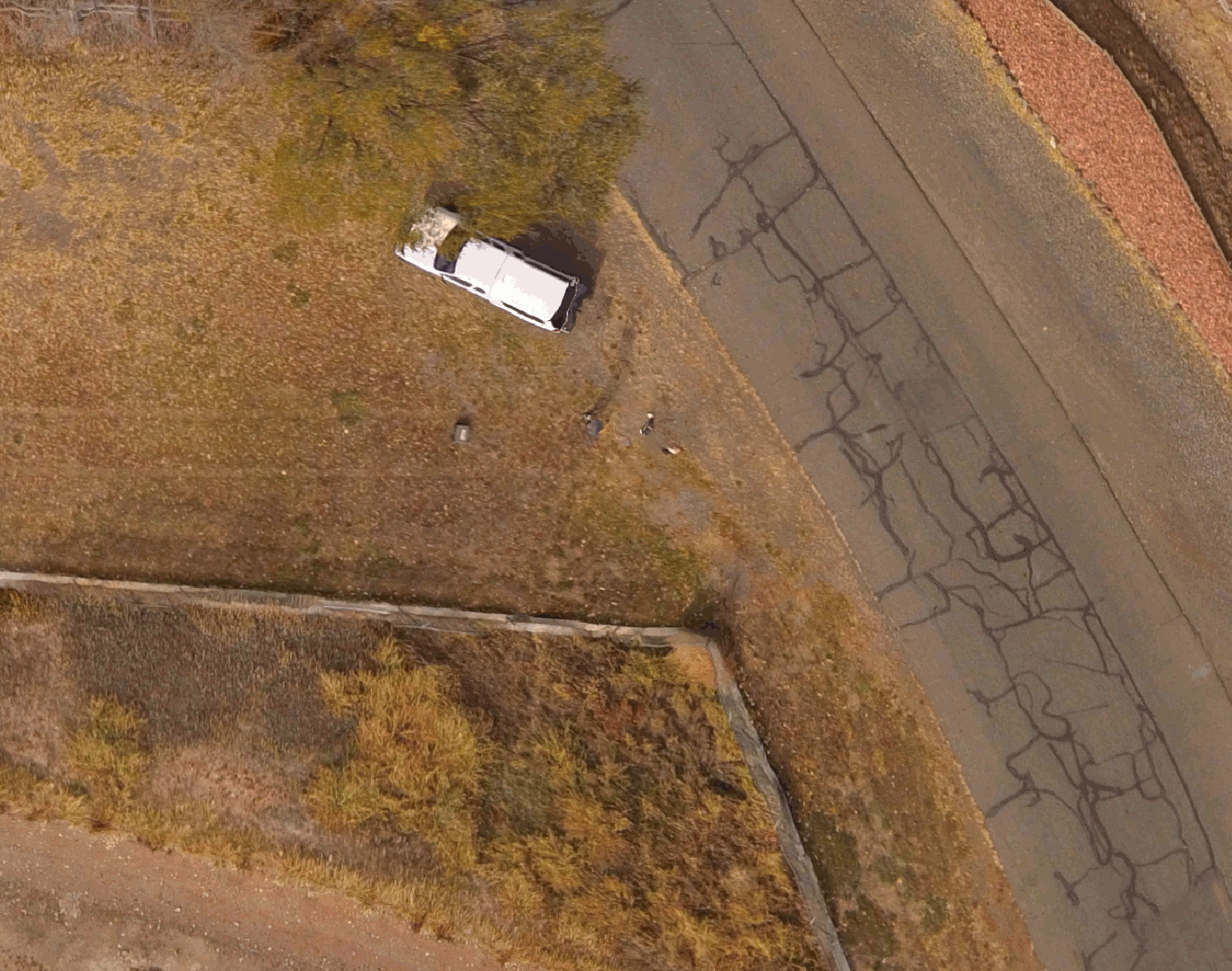
Orthophoto over truck, fence, road, vegetation:

Comparison of MICMAC and ODM orthophotos over road, fence, and truck

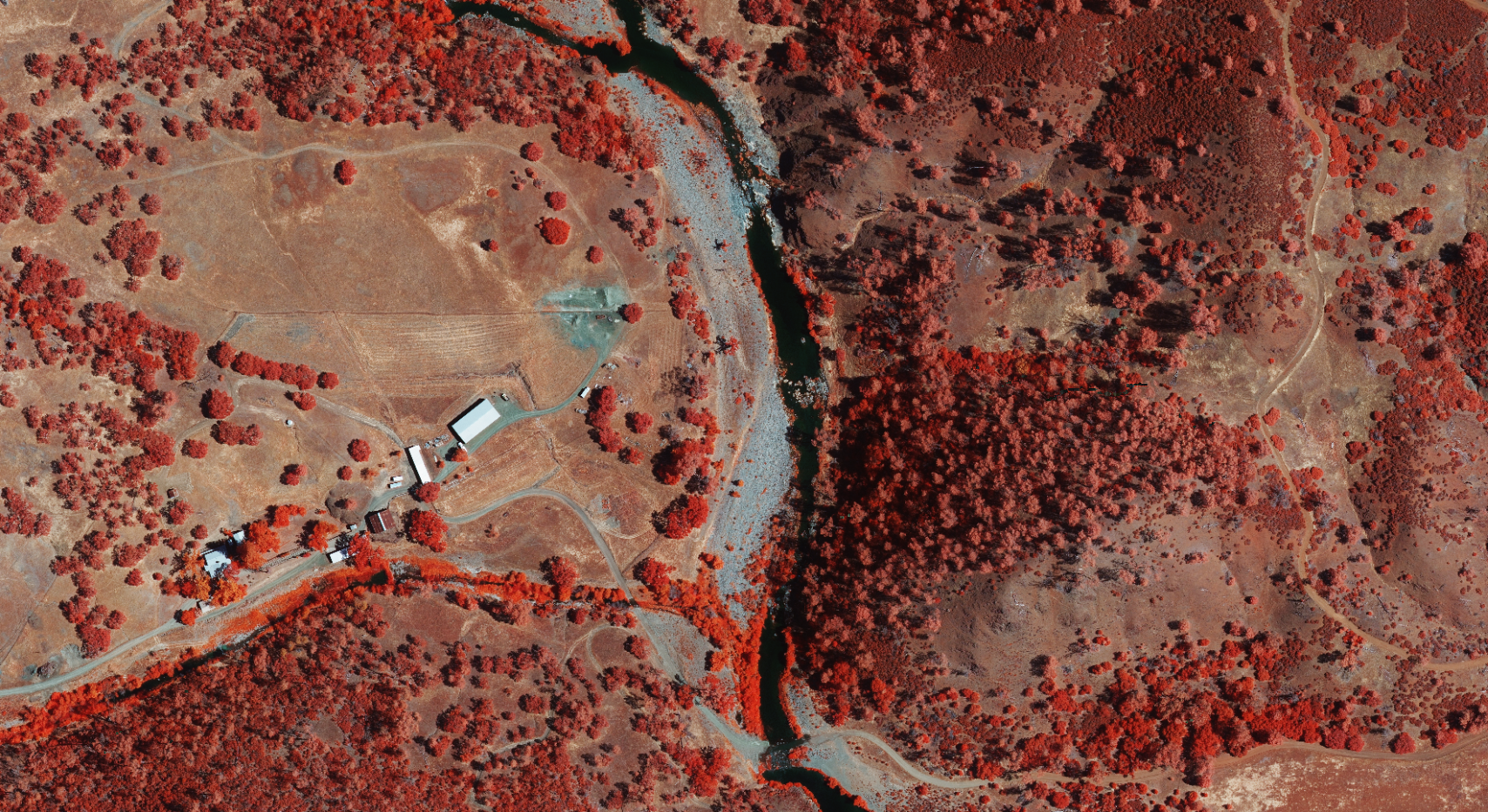
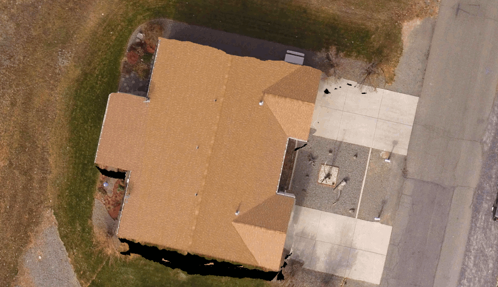
Orthophoto over a duplex house:

Comparison of orthophoto of house between MICMAC and OpenDroneMap

Takeaways

MICMAC is, as it’s reputation indicates, a bit of a grail. It gives us some very nice results, and now simply at the expense of spinning up a docker instance. Watch this space the next few weeks — Masserano Labs will be working with DroneMapper on integrating it into WebODM and quickly graduating it to a first class citizen of the OpenDroneMap ecosystem.

So, will NodeMICMAC replace NodeODM and all the work in ODM? Not so fast! There’s still space for what we’ve built. Remember my intro above? Of course you do. With upcoming capacity to handle massive datasets, NodeODM, PyODM, ODM, and other projects will still get our love. But as they say, if you can’t beat them, have them join you. Right? I think that’s the phrase… . Perhaps MICMAC isn’t joining OpenDroneMap, but we will be happy to fork their code and contribute back where we can, and thanks to JP and DroneMapper for making this possible!

Original Article @ OpenDroneMap by Stephen Mather

The post NodeMICMAC – a new WebODM Node appeared first on DroneMapper.

RAPID Update

$
0
0
DroneMapper has just released an updated version of RAPID with full photogrammetry capability addressing affordability for smaller areas of interest. The RAPID Windows application provides functionality equivalent to REMOTE EXPERT:

  • Selectable DEM and Ortho output resolutions,
  • 64-bit Point Cloud outputs - traditional and textured meshes,
  • Ground control pre-processing for high geo-spatial accuracy,
  • Processing of RTK and PPK image geotags,
  • Processing of nadir as well as oblique collections,
  • Multi-spectral image processing,
  • Ortho seamline feathering and blending,
  • Frequent software enhancements at no additional cost.
RAPID is licensed for 1 year at a cost of $159. The application will ingest up to 250 images per project and run on modest computing resources.

When you download the software and install try running an imagery set of your own or use one of our example sets to produce a preview. RAPID will ONLY produce a preview and requires license purchase to complete the DEM and Ortho. When the DEM "go" button is clicked a Paypal window will open prompting payment. Once paid an activation code will be sent via email for your yearly license. DroneMapper will only accept Paypal payments for RAPID.

The DroneMapper Team!

The post RAPID Update appeared first on DroneMapper.

Drone Mapping Video Tutorials

$
0
0
We are generating a set of video tutorials to help users get setup and run your imagery collections efficiently using REMOTE EXPERT or RAPID. We hope that these will provide some insight on how your various processing needs can be met and the options you can select for your specific scene. We understand we're not all photogrammetry experts and provide these tutorials to help you select the best options for the dataset you collected and possibly more importantly, how you can modify your future collections to produce acceptable products for your applications and customers.

Please click on this link to access videos by topic: https://dronemapper.com/video-tutorials.

Check back often as we will updating this link with more material. Feel free to contact us with comments, critique and other topics you want to see.covered.

The very best from us, The DroneMapper Team

The post Drone Mapping Video Tutorials appeared first on DroneMapper.

Using the Max Flow/Min Cut DEM algorithm for accurate volumetrics

$
0
0
capacity-map

Figure 1

It's that time of the season again where water resource managers are checking their emptied reservoirs for possible silt-in and verification of water holding capacities. We recently flew one of these reservoirs on the south side of the Grand Mesa in western Colorado with our Phantom 3 and a set of ground surveyed aerial targets. The imagery and control were processed using two different DEM generation algorithms, the results of which are presented and discussed here.

Figure 1 illustrates the ortho of the area with the ground surveyed targets and other points depicted as black dots. Figure 2 shows the DEM construction using our standard algorithm. The black oval highlights DEM decorrelation where the vegetation and shadows obscure the NW bank of the reservoir causing erroneous elevation rendering. Figure 3 shows the DEM construction utilizing the max flow/min cut DEM algorithm with greatly enhanced correlation in the same area previously highlighted.

We use Global Mapper to generate contours at specific elevations of interest ranging from reservoir drain or dead pool to maximum capacity or spill elevation. Each contour generated is converted to a flat water elevation surface and the volume between that surface and the DEM reservoir surface is computed. Take a look at what happens when contours are generated on a locally decorrelated DEM in Figure 4. One can see the contours are moving into the NW vegetated area which produces higher volumetric and surface area estimates than reality. As a comparison Figure 5 using the Max/Flow/Min Cut algorithm demonstrates more accurate rendering of the contours and subsequently higher accuracy volume estimates.

Image

Figure 2

Image

Figure 3

Image

Figure 4

Image

Figure 5

The post Using the Max Flow/Min Cut DEM algorithm for accurate volumetrics appeared first on DroneMapper.

Data Science Basic Crop Analysis with UAV Imagery and Micasense Altum

$
0
0

https://github.com/dronemapper-io/CropAnalysis

A jupyter notebook with crop analysis algorithms utilizing digital elevation models, dtm and multi-spectral imagery (R-G-B-NIR-Rededge-Thermal) from a MicaSense Altum sensor processed with DroneMapper Remote Expert.

Due to limitations on git file sizes, you will need to download the GeoTIFF data for this project from the following url: https://dronemapper.com/software/DroneMapper_CropAnalysis_Data.zip. Once that has been completed, extract the TIF files into the notebook data directory matching the structure below.

Included Data

  • data/DrnMppr-DEM-AOI.tif – 32bit georeferenced digital elevation model
  • data/DrnMppr-ORT-AOI.tif – 16bit georeferenced orthomosaic (Red-Green-Blue-NIR-Rededge-Thermal)
  • data/DrnMppr-DTM-AOI.tif – 32bit georeferenced dtm
  • data/plant_count.shp – plant count AOI
  • data/plots_1.shp – plot 1 AOI
  • data/plots_2.shp – plot 2 AOI
  • output/*.csv – output csv of dataframes

Algorithms

  • plot volume/biomass
  • plot canopy height
  • plot ndvi zonal statistics
  • plot thermals
  • plant count

Notes

These basic algorithms are intended to get you started and interested in multi-spectral processing and analysis.

The orthomosaic, digital elevation model, and dtm were clipped to an AOI using GlobalMapper. The shapefile plots were also generated using GlobalMapper grid tool. We highly recommend GlobalMapper for GIS work!

We cloned the MicaSense imageprocessing repository and created the Batch Processing DroneMapper.ipynb notebook which allows you to quickly align and stack a Altum or RedEdge dataset creating the correct TIF files with EXIF/GPS metadata preserved. These stacked TIF files are then directly loaded into DroneMapper Remote Expert for processing.

This notebook assumes the user has basic knowledge of setting up their python environment, importing libraries and working inside jupyter.

Do More!

Implement additional algorithms like NDRE or alternative methods for plant counts. Submit a pull request to the repo!

Load Digital Elevation Model and Orthomosaic

Orthomosaic-DigitalElevationModel

Load Plot 1 AOI and Generate NDVI

ndvi_zonal_statistics

Generate NDVI Zonal Statistics For Each Plot

 ndvi_zonal_statistics_plots
geometry LAYER MAP_NAME NAME min max mean count std median
0 POLYGON Z ((289583.708 5130289.226 0.000, 2895… Coverage/Quad User Created Features 2 0.188461 0.873092 0.438559 4444 0.078921 0.436500
1 POLYGON Z ((289588.705 5130289.052 0.000, 2895… Coverage/Quad User Created Features 3 0.193214 0.887971 0.445282 4440 0.091090 0.425304
2 POLYGON Z ((289593.702 5130288.877 0.000, 2895… Coverage/Quad User Created Features 4 0.232222 0.890147 0.552864 4440 0.112440 0.519746
3 POLYGON Z ((289598.699 5130288.703 0.000, 2896… Coverage/Quad User Created Features 5 0.090825 0.865083 0.530295 4444 0.110570 0.515392
4 POLYGON Z ((289603.696 5130288.528 0.000, 2896… Coverage/Quad User Created Features 6 0.104697 0.922450 0.536660 4442 0.132731 0.495813

Load Plot 2 AOI & Compute DEM Canopy Mean Height For Each Plot

 canopy_height_dem
geometry LAYER MAP_NAME NAME min max mean count std median
0 POLYGON Z ((289707.875 5130279.812 1182.502, 2… Coverage/Quad User Created Features – Coverage/Quad 1 360.129120 363.381683 361.141294 3318 1.091593 360.441467
1 POLYGON Z ((289712.189 5130279.586 1190.569, 2… Coverage/Quad User Created Features – Coverage/Quad 2 360.131866 363.382446 361.710297 3316 1.215926 361.927017
2 POLYGON Z ((289716.503 5130279.360 1183.212, 2… Coverage/Quad User Created Features – Coverage/Quad 3 360.117279 363.384766 361.138592 3310 1.122890 360.425781
3 POLYGON Z ((289720.817 5130279.134 1182.668, 2… Coverage/Quad User Created Features – Coverage/Quad 4 360.110443 363.387207 361.915436 3322 1.258644 362.585251
4 POLYGON Z ((289725.131 5130278.908 1182.782, 2… Coverage/Quad User Created Features – Coverage/Quad 5 360.006683 363.377991 361.558501 3320 1.305164 360.546524

Compute Thermal Mean For Each Plot

The thermal band (5) in the processed orthomosaic shows stitching artifacts which could likely be improved using more accurate pre-processing alignment and de-distortion algorithms. You can find more information about these functions in the MicaSense imageprocessing github repository. See notes at the top of this notebook.

 
geometry LAYER MAP_NAME NAME min max mean count std median
0 POLYGON Z ((289707.875 5130279.812 1182.502, 2… Coverage/Quad User Created Features – Coverage/Quad 1 30008.0 30431.0 30196.628692 3318 120.982058 30193.0
1 POLYGON Z ((289712.189 5130279.586 1190.569, 2… Coverage/Quad User Created Features – Coverage/Quad 2 30068.0 30560.0 30333.192702 3316 123.856093 30332.0
2 POLYGON Z ((289716.503 5130279.360 1183.212, 2… Coverage/Quad User Created Features – Coverage/Quad 3 29792.0 30645.0 30266.030211 3310 170.831207 30275.5
3 POLYGON Z ((289720.817 5130279.134 1182.668, 2… Coverage/Quad User Created Features – Coverage/Quad 4 29790.0 30700.0 30386.137267 3322 201.266919 30391.0
4 POLYGON Z ((289725.131 5130278.908 1182.782, 2… Coverage/Quad User Created Features – Coverage/Quad 5 29618.0 30691.0 30209.904518 3320 292.299392 30262.0

Load Plot 1 AOI & Compute Volume/Biomass For Each Plot

biomass
geometry LAYER MAP_NAME NAME min max mean count sum volume_m3 area_m2
0 POLYGON Z ((289583.708 5130289.226 0.000, 2895… Coverage/Quad User Created Features 2 -0.153473 3.525543 1.532524 4444 6810.538483 76.650368 50.0
1 POLYGON Z ((289588.705 5130289.052 0.000, 2895… Coverage/Quad User Created Features 3 -0.094482 3.575226 1.646664 4440 7311.188690 82.285021 50.0
2 POLYGON Z ((289593.702 5130288.877 0.000, 2895… Coverage/Quad User Created Features 4 -0.070648 3.992493 1.884596 4440 8367.608276 94.174676 50.0
3 POLYGON Z ((289598.699 5130288.703 0.000, 2896… Coverage/Quad User Created Features 5 0.032928 4.575989 2.969443 4444 13196.202637 148.518915 50.0
4 POLYGON Z ((289603.696 5130288.528 0.000, 2896… Coverage/Quad User Created Features 6 0.074188 5.105408 3.155879 4442 14018.412506 157.772617 50.0

Load Plant Count AOI & Count Plants

plant_count
plant_count
Plant count: 310
UTMX UTMY
0 289622.411171 5130240.899705
1 289621.849705 5130244.325966
2 289622.101569 5130248.858655
3 289621.865086 5130253.863387
4 289621.436280 5130258.158493

Thanks! Keep an eye out for future notebooks and algorithms.

The post Data Science Basic Crop Analysis with UAV Imagery and Micasense Altum appeared first on DroneMapper.


Lowering the Cost of Continuous Streamflow Monitoring Award, January 21, 2020

$
0
0
The Bureau of Reclamation and the US Geological Survey conducted a challenge in 2019 to solicit approaches for the reduction of cost associated with streamflow monitoring at gaging sites throughout the US. "...continuous streamflow monitoring stations are vital to water resources planning, design, management and research." With budget and project priority pressures the number of gaging sites nationally is in decline.

DroneMapper was one of five selected finalists in the challenge offering an approach using a 3D sensor for continuous remote sensing of the water surface and the use of UAS for stream channel characterization to improve hydrological modeling and simulation. The Bureau and USGS award press release is viewed here: https://www.usbr.gov/newsroom/stories/detail.cfm?RecordID=69224

We are very interested in pursuing this technology further for US Government, state and local use. We are in the process of identifying investment alternatives that would promote further development and verification of the 3D sensor. Please do not hesitate to contact us if you have or know of someone that has an interest in supporting this venture. Please contact Pierre Stoermer, CEO DroneMapper, (970) 417-1102

Many thanks from the DroneMapper Team!!

The post Lowering the Cost of Continuous Streamflow Monitoring Award, January 21, 2020 appeared first on DroneMapper.

AquaBits.io Cutting Edge Water Management Solutions

$
0
0
aquabits sensor
In the last few months DroneMapper has developed a terrestrial sensor (AquaBits IoT) focused on water resource management. This post describes our development, verification and capabilities for an affordable, real time device sensing flowing water in channels and continuous measurement of reservoir holding capacities. Previously we described the use of drone imagery collection, precision imagery processing and generation of reservoir basin contours from the DEM for water elevation correlation to storage capacity. This data can now be augmented with real time reporting of actual reservoir stage at any frequency of interest, with little latency to water managers.

AquaBits utilizes accurate hydrostatic pressure measurement of the water column and is self contained inclusive of a power subsystem and communication capability using either cellular (when available) or satellite for remote locations. Data is transmitted to our secure dashboard where it is archived and processed for discharge in a flowing channel or current water stage in a reservoir. A slide deck with an overview of AquaBits and recently collected data compared to Colorado State instrumentation can be found here: (pdf attached)

In other scenarios when equipped with the appropriate sensor(s), applications to consider may include soil nutrient/moisture measurement for agriculture, earth subsidence/movement, chemical contamination, water quality, audio/visual surveillance, limited only by the imagination... Feel free to contact us and discuss your specific application.

The DroneMapper Team

aquabits.io

The post AquaBits.io Cutting Edge Water Management Solutions appeared first on DroneMapper.

DroneMapper Photogrammetry Software Updates 2021

$
0
0
We've been busy working on enhancements to the DroneMapper Photogrammetry Software package and a handful of exciting enterprise projects! Please take a look at the software changelog below for the latest updates and features. We always appreciate customer suggestions and feedback to improve our offerings. Please contact us anytime with your ideas!

Thanks, DroneMapper Team

February 10th, 2021 - v1.9.2 20210210
  • Customer suggested feature: change resolution of RGB orthomosaic preview. Default setting is 8x native GSD with new settings options for 4x GSD and 2x GSD. Allows rapid production of RGB preview orthomosaic in the field supporting disaster mapping and emergency operations.
color orthomosaic
January 22nd, 2021 - v1.9.1 20210122
  • Remove twitter icon/link from UI
  • Remove license clean exe (false flag as malware by anti-virus)
November 26th, 2020 - v1.9.1 20201126
  • Bitcoin, Eth and other crypto payments accepted via coinbase.com
  • Enhance GPU tie point generator, performance optimizations
November 4th, 2020 - v1.9.1 20201104
  • New tie point reduction algorithm. Useful for large datasets, imagery with large feature counts, or when using Brisk/Akaze/Multi-Scale TP. Algorithm filters and selects the best tie points based on score, limits tie points to a reasonable count per image pair. Speeds up large dataset processing.
  • Initial CUDA based tie-point detector and feature matching. Requires a NVIDIA GPU and driver >= 418.39 (beta), utilizes CPU and GPU CUDA cores.
    CUDA SDK: 10.1 (10.1.105) DRIVER >= 418.39 NVIDIA CUDA: Ver 10.1 - CUFFT CUBLAS NVIDIA GPU Archs: 30 35 37 50 52 60 61 70 75
October 26th, 2020 - v1.9 20201026
  • Fix for GCP processing in Stereo/Per Image Matching mode
  • UI and about dialog updates
  • Update to latest exiftool v12.06

The post DroneMapper Photogrammetry Software Updates 2021 appeared first on DroneMapper.

Water Resource Management – Drone Mapping and AquaBits

$
0
0
DroneMapper recently mapped a mid-sized reservoir, Hotel Twin Lake, located on the top of the Grand Mesa in Colorado, USA. Figure 1 shows a Google image of the lake at full capacity:


Hotel Twin was drained to its deadpool prior to our drone imagery collection and placement of aerial targets for mapping and ground surveying. 342 images were acquired using a Phantom 3 Advanced drone and six (6) aerial targets or Ground Control Points (GCPs) were precisely ground surveyed for XYZ locations. The imagery and GCPs were processed using REMOTE EXPERT software. Figure 2 illustrates the DEM with GCPs constructed of the reservoir basin:


The ground survey of the GCPs was performed using a Trimble GPS/RTK 5800 Base and Rover communicating over a 25-watt UHF Trimble radio (TrimMark 3). The GCP ground surveyed elevations were compared to the elevations measured on the DEM and are shown in Table 1:


Using Global Mapper GIS software (Blue Marble Geographics, Hallowell Maine) 1-foot contours were generated from the gate valve invert (reservoir’s drain) up to spill. Figure 3 illustrates the DEM with contours superimposed:


Reservoir storage capacity (acre-feet) was computed for each 1-foot contour. The data was fit to a 3rd-order polynomial as shown in the following Figure 4 plot:


The coefficient of determination, R2, indicates an exceptionally good fit with the 3rd-order polynomial model. You may be asking “what do you do with the polynomial model?” Topic of next discussion -

AquaBits – Real Time Monitoring of Water Resources

AquaBits is an accurate water resource monitor measuring/reporting gage height of reservoirs and open channels in real time. Water gage height is measured using an immersible hydrostatic pressure, industrial grade sensor. AquaBits reads the sensor at prescribed intervals and sends the measurement using either cellular or satellite communication modems to our aquabits.io web site within 1-minute of data acquisition. Figure 5 illustrates an AquaBits installation for an open channel application:


AquaBits is shown to the left with Colorado state instruments to the right. For Hotel Twin Lake AquaBits was mounted to an existing steel support structure as shown in Figure 6:


The water sensor is run from the electronics box (just below the solar panel) to the reservoir’s gate valve invert or drain. For this application AquaBits reports every 6-hours and the stored capacity as a function of water elevation is computed using the previously described polynomial model. The lake’s location is remote with no cellular service dictating the use of a satellite modem for data transfer to aquabits.io. Figure 7 shows recent July 2021 data from aquabits.io indicating a slow growth of storage capacity over a couple of days.


This type of data is particularly useful to understand water ingress, discharge, lake evaporation and possibly predict reservoir’s storage through winter and spring months prior to full thaw and start of the next irrigation season.

Special Equipment and Software Offer

DroneMapper has a hot July special equipment and software offering – a complete drone mapping system with Trimble ground survey and processing software including the following:

    • DJI Phantom 3 Advanced drone complete with Pelican roller case (see Figure 8):
      Less than 1 hour flight time on P3A (used as backup spare for our operations),
      Additional NIR modified camera (NIR,G,B) used for crop health monitoring,
      Value estimated at $500-1,000 (used)


    • Trimble GPS RTK 5800 Base, Rover and UHF Radio complete, housed within two cases (see Figures 9 & 10):
      Base and Rover Receivers (batteries/charger included),
      TSC Controller (battery/charger included),
      2-10-25-watt, 450-470 MHz Radio (battery not included)
      All cables and antennas,
      Value estimated at $3,000-4,000 (used)


    • Perpetual license for REMOTE EXPERT photogrammetric processing software:
      Produce DEMs, orthos, point clouds, with or without GCPs,
      License cost - $999

    • Complete precision mapping system offered at $3,500 plus shipping. All you need to add is the aerial targets, tripods and survey rods.

  • Thanks for looking at our blog and please contact us with any questions regarding mapping, AquaBits or our special. The very best for this summer and onwards!

    The post Water Resource Management – Drone Mapping and AquaBits appeared first on DroneMapper.

    DroneMapper Software Updates 2022

    $
    0
    0
    We've released a new version of the software with new features:

  • Orthomosaic optimizations & disk space fixes
  • New GeoTagger function (accepts csv with image names or timestamp for tagging) – BETA
  • New MicaSense image stacker (stacks raw micasense images w/ radiometric corrections) – BETA
  • UI tweaks & fixes
  • UI progress bar and tasks processing fixes
  • New Sentera image stacker (stacks raw sentera images w/ radiometric corrections) – COMING NEXT RELEASE!

  • Please see our Medium page for more details on the Image Stacker and Geotag feature:
    https://medium.com/@dronemapper

    The post DroneMapper Software Updates 2022 appeared first on DroneMapper.

    Viewing all 100 articles
    Browse latest View live